5 dead after powerful quake strikes in South Pacific
updated 5:30 AM EST, Wed February 6, 2013

Four elderly people and
one child died after the roughly 1-meter (3-feet) high wave hit the
Santa Cruz Islands, an eastern region of the Solomon Islands, said
Augustine Bilve, a director at a hospital in Lata, the main town in the
area.
The strong waves appeared to have caused damage and disruption at the local airport and nearby villages.
Bilve said that some patients were being relocated, but the hospital was intact.
"Our staff in Temotu
province felt the quake and within five minutes there were a number of
wave surges, which flooded the runway there," said Andrew Catford, the
program director in the Solomon Islands for the humanitarian group World
Vision.

Temotu province is another name for the Santa Cruz Islands.
World Vision said it was
still trying to gauge the damage from the tsunami in the area, adding
that "it is likely that several villages close to the airport have been
severely impacted."
The Pacific Tsunami
Warning Center initially issued a tsunami warning for several countries
in the area, including Papua New Guinea and Fiji. But the center later
canceled the alert after reassessing the relevant data.
It also called off a
tsunami watch it had sent out for a larger number of countries in the
region such as New Zealand, Australia and Indonesia.
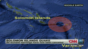
The center of the quake
was located near the Santa Cruz Islands, the U.S. Geological Survey
(USGS) said. It was initially reported to be 3.6 miles deep, but that
was later revised to a depth of 17.8 miles.
Precautionary measures taken in the region
Authorities elsewhere in the region took precautionary measures following news of the quake.
The New Zealand Ministry
of Civil Defense and Emergency Management warned people along certain
areas of the country's west coast to stay out of the water and away from
the shore.
Japanese authorities
issued advisories that small sea level changes could affect the
country's entire eastern coastline Wednesday.
The New Caledonia High
Commission in the capital of Noumea ordered the immediate evacuation of
coastal residents on the eastern coast of New Caledonia and the Loyalty
Islands.
The main quake was
preceded by a 6.3-magnitude quake in the region and was followed by
several others, the largest of which had a magnitude of 6.6, the USGS
said.
In 2007, an
8.1-magnitude quake struck in the western part of the Solomon Islands,
setting off a tsunami. At least 52 people died as a result of the
disaster and thousands of others were left homeless.
CNN's Sarita Harilela, Jethro Mullen and Dave Alsup contributed to this report.
First Aid, Survival, and CPR: Home and Field Pocket Guide by Jones, Sh (Google Affiliate Ad)
www.facebook.com/MadtownPreppers
http://www.ebay.com/cln/nebshipshop


https://plus.google.com/u/0/b/111683883276512811730/+MadtownpreppersBlogspot/posts
http://www.ebay.com/sch/nebshipshop/m.html?_nkw=&_armrs=1&_ipg=&_from=
M8.0 - SANTA CRUZ ISLANDS 2013-02-06 01:12:27 UTC


 Google Earth KML
Summary
Location and Magnitude contributed by: USGS, NEIC, Golden, Colorado (and predecessors)
General
1000 km
1000 mi
Powered by Leaflet
10.738°S, 165.138°E
Depth: 28.7km (17.8mi)
Depth: 28.7km (17.8mi)
Event Time
- 2013-02-06 01:12:27 UTC
- 2013-02-05 19:12:27 UTC-06:00 system time
Location
10.738°S 165.138°E depth=28.7km (17.8mi)Tectonic Summary
The February 6th,
2013 M 8.0 earthquake in the Santa Cruz Islands occurred as a result of
shallow thrust faulting on or near the plate boundary interface between
the Australia and Pacific plates. In the region of this earthquake, the
Australia plate converges with and subducts beneath the Pacific plate,
moving towards the east-northeast at a rate of approximately 94 mm/yr.
The February 6th earthquake is located approximately 700-750 km ESE of the Mw 8.1 Solomon Islands earthquake of April 1, 2007, and the Mw 7.1 Solomon Island earthquake of January 3, 2010. It is over 900 km to NNW of the February 2, 2012 Mw 7.1 Vanuatu earthquake, and approximately 200-300 km north of a series of earthquakes in October, 2009 along the Vanuatu Trench that included two earthquakes larger than magnitude 7 (Mw 7.8, Mw 7.4).
This earthquake is located adjacent to a complex section of the Australia-Pacific plate boundary, where the Solomon Trench to the west is linked to the New Hebrides (Vanuatu) Trench to the south by a short segment of dominantly strike-slip plate motion. The February 6th earthquake is located at the northern end of the New Hebrides (Vanuatu) segment. To the north and west of this event, the plate boundary changes in character, is oriented more west-to-east, and connects the segment ruptured by this event with the continuation of the subduction zone along the Solomon Islands.
Over the month leading up to the February 6th earthquake, there have been dozens of earthquakes in the epicentral region – over 40 M4.5 or larger in the preceding 7 days alone, 7 of which were larger than M6. Faulting mechanisms for these earthquakes suggest a mixture of strike-slip, normal and thrust faulting events. Within an hour of the February 6th M8.0 mainshock, there were also two large aftershocks with magnitudes greater than M6. See a map of current aftershocks here.
www.facebook.com/MadtownPreppers
 |
| Be Prepared for Biological Outbreaks with a Pandemic Influenza #QuickKit +NebShip Shop |

 | |
| fb: Madtown Preppers Page +Madtown Preppers @MadtownPreppers |
Madtown Preppers Alerts are for informational use only. These alerts purpose is to inform you of news events in order for you to adjust your family preparedness programs. We believe that knowledge is power and in order for you to make informed decisions, we try and bring you verified information, not to increase fear but to inform you. We do not endorse any of the sources we link to in any article.
http://www.ebay.com/sch/nebshipshop/m.html?_nkw=&_armrs=1&_ipg=&_from=

Madtown Preppers Alerts are for informational use
only. These alerts purpose is to inform you of news events in order for
you to adjust your family preparedness programs. We believe that
knowledge is power and in order for you to make informed decisions, we
try and bring you verified information, not to increase fear but to
inform you. We do not endorse any of the sources we link to in any
article.
No comments:
Post a Comment